


Riverwho? Riverwhat? Riverwhere?
A Glossary of Terms
1 Mississippi: A public outreach program of the Mississippi River Network (MRN) and a growing national movement of over 20,000 River Citizens.
6 Simple Things You Can Do To Save the Mississippi River: A 26-page River Action handbook for homeowners with best management practices, a glossary of terms, and a resource guide for reducing stormwater runoff. It is free and available at River Action or online at www.riveraction.org.
Adopt A Path: A River Action program with families, individuals, and organizations to pick up cans, litter, and other debris from Mississippi River, Duck Creek, and Rock River recreation trails in ½ mile segments.
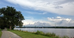
American Discovery Trail: A cross-country hiking and biking trail from California to Delaware. It crosses the Mississippi in the Quad Cities on the Arsenal Bridge.
Aquifer: A body of rock or sediment that holds groundwater. These are often over drawn beyond what is sustainable.
BMP: Best Management Practice. Devices, technologies, and techniques used to manage a resource or a process in the best way possible
Bioswale: A landscape feature used to capture, detain, and cleanse stormwater runoff using native plants and subsurface gravel.
BioBlitz: An annual event that focuses on looking closely at local nature and teaching kids about the wonders that can be found in their own backyards.
Bi-CAN: Bi-State Conservation Alliance Network focuses on conservation efforts through partnerships and community engagement
Bi-State Regional Trails Council: An entity created and staffed by the Bi-State Regional Commission in 2004 that oversees regional trail planning.
Bottomland Hardwood Forests: Deciduous and evergreen forests found in lowland floodplains along large rivers that are periodically flooded.
Brownfield: A planning term referring to a site that has been contaminated or contains infrastructure from historical industrial use.
Channel Cat Water Taxi: Launched by River Action in 1995 and now managed by MetroLink, this open-air passenger ferry accommodates 47 people and seven bicycles.
Channel Cat Talks: Educational lectures aboard the Channel Cat Water Taxi as part of River Action’s Explore the River Series.
Corn Belt Ports: A multi-state initiative to establish federally recognized port regions on the Upper Mississippi River.
CRS: Community Rating System, a voluntary FEMA program encouraging floodplain management beyond NFIP requirements.
Davenport Riverfront Improvement Commission: An 11-member commission charged with stewardship and management of Davenport’s riverfront.
Detention pond/basin: A water catchment device used to temporarily hold stormwater before controlled release.
DNR Iowa: Iowa Department of Natural Resources, responsible for parks, wildlife, and environmental protection.
DNR Illinois: Illinois Department of Natural Resources, overseeing conservation laws and state parks.
Eddy: A movement of water counter to a main current, creating a small whirlpool.
Eddy Awards: Awards recognizing individuals and organizations who have moved against the current through impactful riverfront work.
EPA (U.S. EPA): United States Environmental Protection Agency.
FIRM: Flood Insurance Rate Maps produced by FEMA.
FEMA: Federal Emergency Management Agency.
Fish & Fire: River Action’s Earth Day celebration featuring the Eddy Awards and catfish dinner.
French Drain: A gravel-filled trench that slows stormwater runoff and reduces erosion.
Getting Back to Our Roots: A 2025 River Action initiative that sought to create or bolster native prairies in Wild Places in and around the Quad Cities. 32.25 acres were donated from River Action to 15 Wild Places in both Illinois and Iowa.
Great River Trail: A 62-mile trail from Rock Island to Savanna, Illinois.
Green Drinks: An international organization with a local chapter sponsored by Progressive Action for the Common Good (PACG) whose purpose is to promote networking and environmental actions in our community
Green Iowa AmeriCorps (GIA): A statewide program that operates through the University of Northern Iowa’s Center for Energy and Environmental Education. It places members with local host sites across Iowa that participate in environmental stewardship, energy efficiency, and community revitalization. Members engage in home energy audits, educational programs, volunteer opportunities, and sustainability projects with the goal of making Iowa a greener state.
Green Roof: A vegetated rooftop that reduces runoff, saves energy, and creates habitat.
Impervious: Typically referring to surfaces that do not readily allow water or moisture to penetrate.
Lights! River! Action! Foundation: The foundation, administered by River Action, that funded the lighting of the Centennial Bridge and continues to fund its maintenance.
Lindsay Park Yacht Club: Established in 1887, it is one of the oldest yacht clubs on the Mississippi River. Located at the foot of Mound Street in Davenport near mile marker 484, the marina has 107 boat slips and a gas dock.
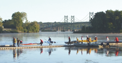
Living Lands & Waters: An environmental nonprofit organization established by Quad City native Chad Pregracke in 1998. Since its founding, LL&W has grown to be the only cleanup organization of its kind in the world. Spending up to nine months a year on a barge, the crew hosts river cleanups, watershed conservation initiatives, workshops, tree plantings, and other conservation efforts.
Milan Bottoms: Approximately 3,500 acres of diverse floodplain including open water wetlands, sloughs, and bottomland forest, located south of the confluence of the Rock River and the Mississippi River in Illinois.
Mississippi Point: Located at the foot of 38th Street in Bettendorf at the mouth of Duck Creek, this city-owned passive park connects to the riverfront trail.
MRCTI: Mississippi River Cities and Towns Initiative addresses shared concerns including river quality, habitat restoration, state coordination around river management, sustainable economies, water conservation, and celebration of river culture and history.
MRN: Mississippi River Network is a coalition of nearly 60 member and partner organizations from the Headwaters to the Gulf working to protect the river. MRN seeks to influence both public policy and people’s perceptions while deepening connections to the Mississippi River.
Nahant Marsh: A former Superfund site restored by River Action into a thriving wetland preserve and environmental education center, now more than 25 years strong.
NFIP: National Flood Insurance Program provides insurance to help reduce the socio-economic impact of floods. The program is managed by FEMA and delivered through more than 50 insurance companies and NFIP Direct.
PACG: Progressive Action for the Common Good is a local nonprofit working toward positive change through social justice and environmental sustainability initiatives.
Partners of Scott County Watersheds: A nonprofit organization dedicated to improving water quality and reducing flood risk in Scott County through education, technical assistance, and financial support for best management practices.
Permeable: The opposite of impervious; a surface that can readily be penetrated by moisture or water.
PFAS: Per- and polyfluoroalkyl substances are a large group of synthetic chemicals that do not easily break down in the environment, often referred to as “forever chemicals.”
PPI: Program for Public Information is a FEMA-supported planning tool that provides a step-by-step coordinated approach to flood hazard outreach.
Propeller Club: A national organization that promotes the American Merchant Marine, harbor improvements, and the development of trade with other countries.
Quad City Conservation Alliance: A local alliance of conservation groups addressing environmental and recreational resource issues in the Quad Cities region. It operates the QCCA Expo Center in Rock Island, Illinois.
Quad City Riverfront Council: Includes representatives from Scott County, Rock Island County, the Quad Cities Chamber, Rock Island Arsenal, the U.S. Army Corps of Engineers, and River Action.
Rain Garden: Similar to a bioswale but lacking a gravel-filled trench, rain gardens rely on moisture-loving native plants to absorb runoff and reduce standing water.
Retain the Rain: A program initiated by River Action in 2002 to raise awareness of stormwater runoff impacts and provide residents with tools to reduce runoff from their properties.
Retention Pond/Basin: A water catchment device designed to capture and hold stormwater for extended periods of time.
Riparian Zones: Vegetated buffer areas along streams, creeks, or rivers that reduce erosion, filter pollutants, and protect water quality.
Riverine Walks: Guided educational walks led by local professionals exploring the environmental, cultural, and historical significance of the Mississippi River and Quad Cities. Part of River Action’s Explore the River Series.
RiverVision Plan: Created in 2004 through an intergovernmental agreement between Davenport and Rock Island to redevelop central city riverfronts as regional attractions. Davenport updated its portion of the plan in 2024.
RiverWay Stories: A Quad Cities NPR segment airing Saturdays that highlights local environmental topics and river-related stories.
Runnel: A small channel or constructed feature that captures and conveys stormwater runoff while allowing some water to infiltrate into the underlying soil.
Stormwater Utility: An entity created by cities or counties to manage excess stormwater. Utilities often fund operations through fees and may offer incentives for reducing runoff. Rock Island, Moline, Bettendorf, and Davenport operate stormwater utilities.
UMBRA: Upper Mississippi River Basin Alliance is a governor-established nonprofit forum for interstate water resource planning with members from Minnesota, Wisconsin, Iowa, and Illinois.
UMRCC: Upper Mississippi River Conservation Committee promotes conservation and management of river resources through voluntary collaboration and hosts an annual public conference.
Upper Mississippi River Refuge: Established in 1924, this refuge stretches 161 river miles from Wabasha, Minnesota, to Rock Island, Illinois and protects over 240,000 acres of floodplain habitat.
Water Table: The level below the ground surface where soil is fully saturated with water.
WEDG: Waterfront Edge Design Guidelines is a science-based voluntary rating system designed to maximize ecological health, resilience, and public access along waterways.
Wild Places: More than 16,000 acres of publicly accessible natural areas within an hour of the Quad Cities, including river corridors, wetlands, bluffs, and uplands. Visit RiverAction.org to explore Quad City Wild Places.
WOTUS: Waters of the United States, a term used in federal policy to define which water bodies fall under Clean Water Act protections.
WOTUS: Waters of the United States, a term used in federal policy to define which water bodies fall under Clean Water Act protections.
Do you see a term that's missing from our glossary? Email Us!

