


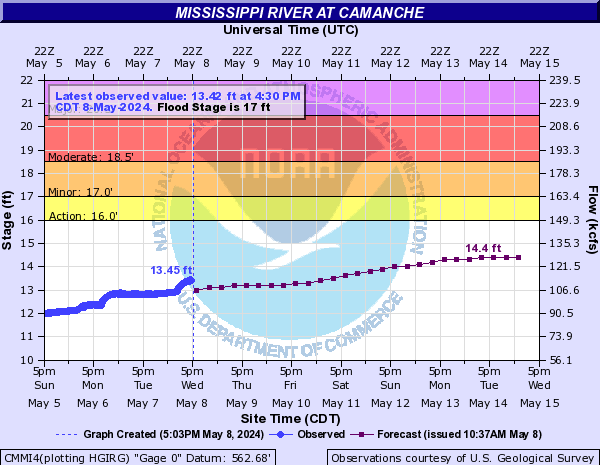
Below are the water levels for area rivers at selected sites. Select a river to jump to that section
Mississippi | Rock | Maquoketa | Iowa | Green
Click on any of the charts below for more information on that location.
Mississippi River
Rock Island

Le Claire

Camanche
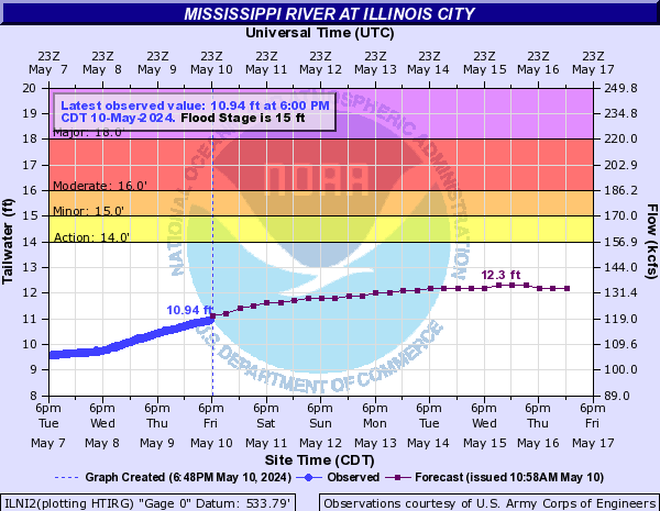
Illinois City
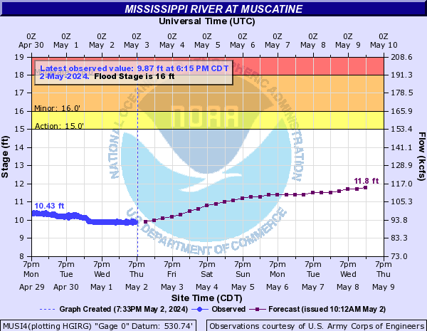
Muscatine
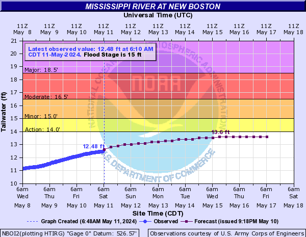
New Boston
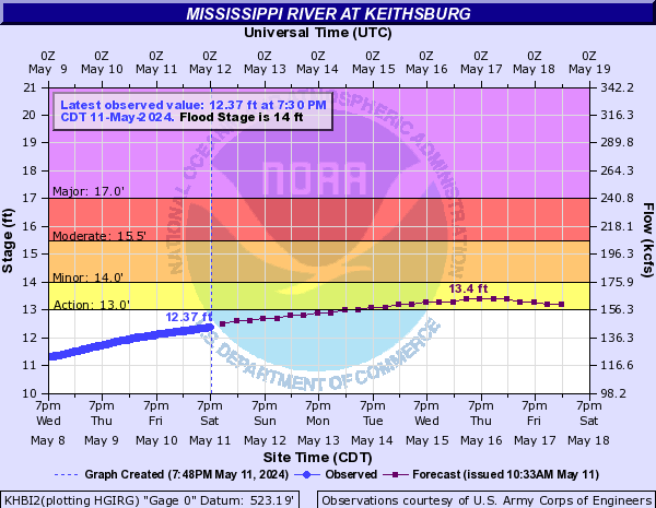
Keithsburg
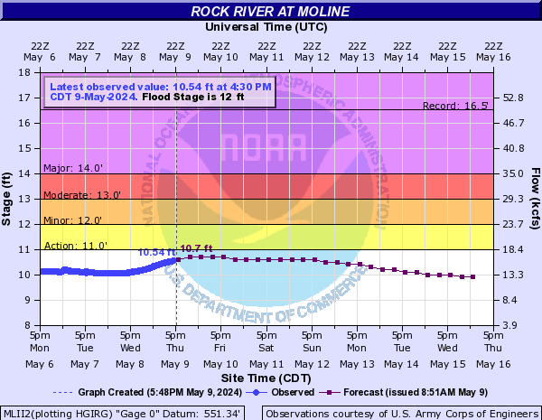
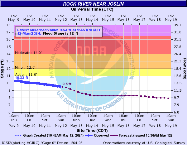
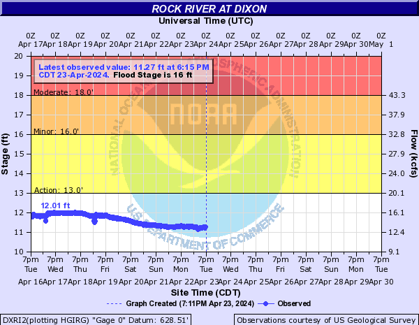
Rock River
Moline
Joslin
Geneseo
Como

Dixon
Maquoketa
Maquoketa

Iowa
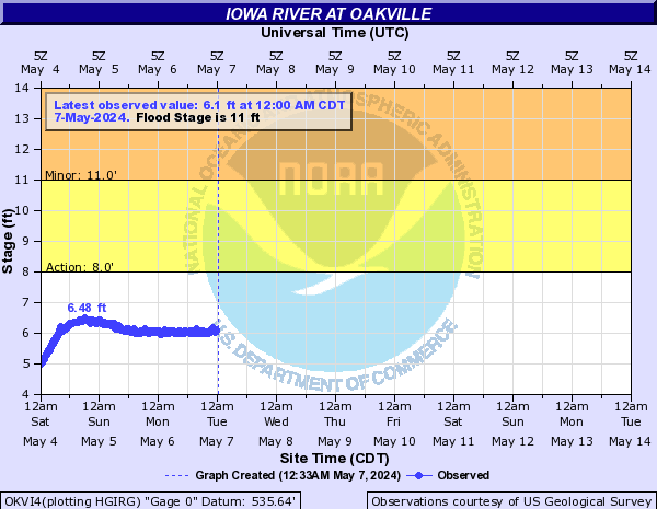
Oakville
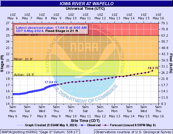
Wapello
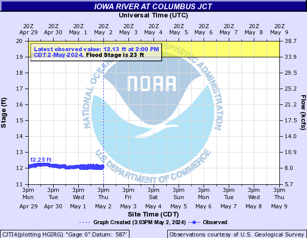
Columbus Junction
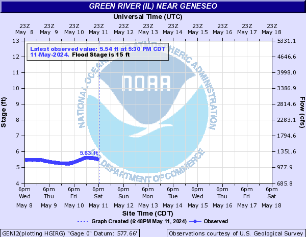
Green
Geneseo

